We are happy to report that both of the Red Knots tracking over the Atlantic Ocean have successfully reached land!
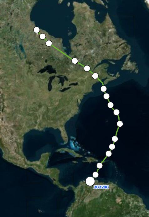
LP7 veered slightly west of the impending storm, flying through the Caribbean Sea before making landfall in Venezuela just a couple hours before midnight on 8/15! It is now at Salina Solar Los Olivitos, a Western Hemisphere Shorebird Reserve Network Site (WHSRN). It traveled for 5 consecutive days and migrated a minimum of 4,000 non-stop miles.
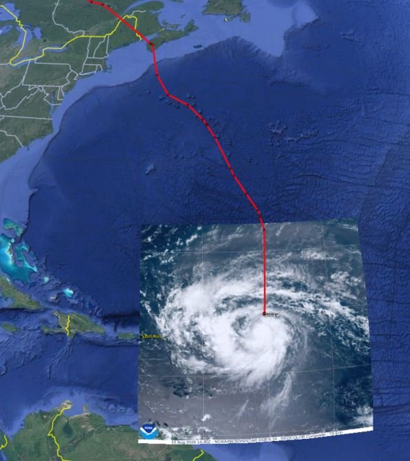
LN5 stayed out in the open Atlantic and likely entered Hurricane Erin in the Northeast quadrant. We noticed a considerable slowdown in its flight as it flew through the storm with average flight speeds as low as 20mph over hundreds of miles as opposed to an average of 38 mph over the first 2000 miles prior to the storm. In total, LN5 traveled for 5 plus days and over 3,800 miles. It ultimately landed in Suriname on the evening of 8/16, and is now at a Western Hemisphere Shorebird Reserve Network site called Coppenamemonding.
LC1 which had been flying along the South Carolina coast, continued south hugging the coastline into Florida, perhaps it sensed the offshore storm?! It then made a slight west turn over Lake Okeechobee and the Florida Keys before touching down in Southwest Cuba. This is our second bird to stop in Cuba this year, and 4th since we began our project
Another exciting development is coming from the Pacific side! LN8 whom had been spending time along the Laguna Madre in Texas and Mexico, has flown over to the Pacific coast of Mexico in the southern Oaxaca region. This is an unusual route per researchers that study the Gulf population. We are working with partners to identify wintering areas through isotope analysis taken from a covert feather at the time of banding and very interested to see if the feather taken from LN8 shows a similar signature as the current location. We expect that these birds winter in the same locations year after year. Caveat…the bird could simply be staging for another flight further south! Stay tuned…
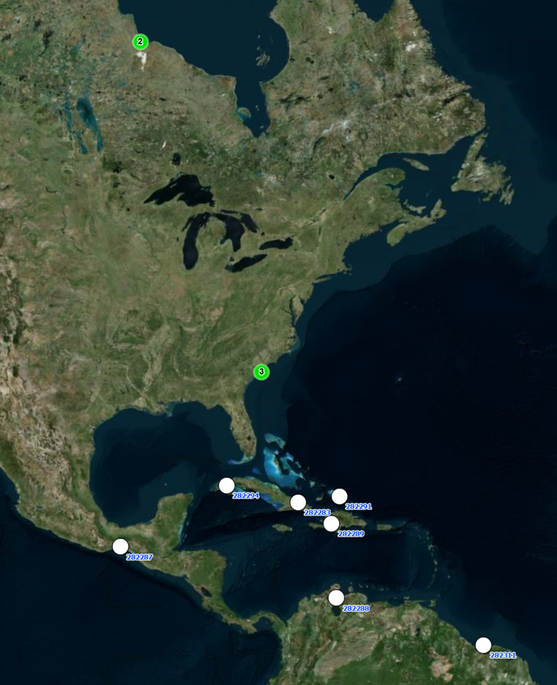
Below is the most recent location of all of our active birds at this time:
Feel free to share widely and encourage others to sign up for the updates here.
As a reminder, this project is a collaboration between the South Carolina Department of Natural Resources, Georgia Department of Natural Resources, Manomet Conservation Sciences, U.S. Fish and Wildlife Service, South Carolina Cooperative Fish and Wildlife Research Unit, and Wildlife Restoration Partnerships.
The solar-powered tags transmit each bird’s location every few hours by communicating with a network of satellites. You can learn more about how the tags and satellites work here.
Past updates can be found here: Update 1, Update 2
Thank you for following the knots!
Written by Cami Duquet, Outreach & Stewardship Coordinator, Coastal Bird Program, SCDNR
Reprinted with permission by Seabrook Island Birders