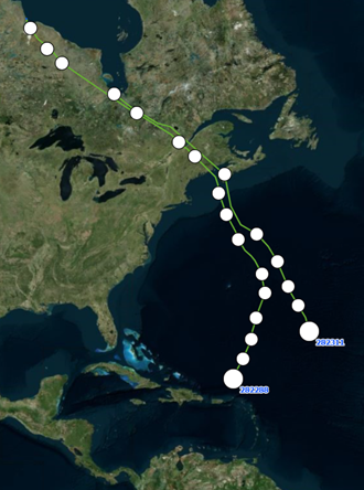
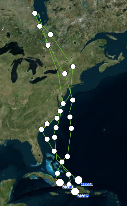
We have big news on the tracking front with two birds (LN5 and LP7) flying over the open Atlantic Ocean, southeast of Bermuda, and possibly on a collision course with tropical system, Erin. LP7 departed from Port Nelson, Hudson Bay, CA on the evening of 8/10, while LN5 left from James Bay, CA a day later on 8/11. LP7 has averaged 36mph for the duration of the non-stop, 82 + hour, 3,011 mile leg thus far. LN5 has flown non-stop 57 + hours and 2,181 miles thus far, averaging 38mph for the duration. We expect the birds could interact with the storm within the next 24-36 hours based on current flight speeds. This is migration in real time!
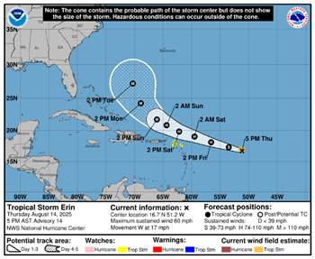
These mid to late August/early September storms take place during peak migration of shorebirds from North to South America/Caribbean, and while the Red Knots are protected by law in most countries, many shorebirds are hunted along the route. We now know that shorebirds are capable of flying through tropical storms/hurricanes, but they may be depleted of energy and have to stop short of the intended destination. This is where shorebirds are possibly exposed to a gauntlet of hunting. Will they be impacted by this storm? How will they respond? Will we ever find out? Stay tuned!
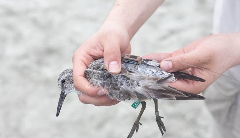
Out of the 27 satellite tags deployed on Red Knots by our project this Spring, we believe 12 are still actively tracking, referred to by their flag code below:
Tags deployed on 3/31/2025 on Kiawah Island SC:
LC1 LK1 LM2
Tags deployed on 5/18/2025 in Cape Romain National Wildlife Refuge SC:
LM9 LN0 LN4
LN5 LN6 LN7
LN8 LP7 LP8
We currently have two birds in Canada on the shores of Hudson Bay (LM2 and LN0). One other (LC1) left Hudson Bay on 8/12 and is currently flying along the South Carolina coast.
On 7/30, LN8 also departed from Hudson Bay, however it went straight south, over the Great Plains of the US, and landed on the southern Texas coast near Padre Island National Seashore. It is spending time along the Laguna Madre and has slowly continued south over the Mexican border.
Four birds have made stops in the Southeast US between Georgia and South Carolina- LK1, LN6, LP8 and LN4.
Fletcher Smith (GADNR) and Allie Hayser (Manomet) were able to get eyes on LN4 on Wolf Island in Georgia on 8/1. It has since crossed into South Carolina and has pinged between Edisto Island and Deveaux Bank Seabird Sanctuary, and most recently Cape Romain National Wildlife Refuge.
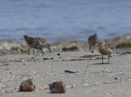
Picture Credit: Allie Hayser
Three birds are currently in the Caribbeans! LN7 left James Bay, CA on 7/29 and made an impressive flight over the Atlantic Ocean before settling in Nipe Bay, Cuba on 8/2 where it has been ever since. LM9 followed a similar flight path, leaving James Bay, CA on the evening of 8/3 and landed on 8/6 just before midnight on the island of Salt Cay, in Turks and Caicos! After a 12-day stay in South Carolina from 8/1 to 8/12, between Charleston Harbor and Edisto Island, LP8 also departed for the Caribbeans and is currently in Haiti, on the shores of Lake Azuei.
Stay tuned for the next Red Knot update soon! Feel free to share widely and encourage others to sign up for the updates here.
As a reminder, this project is a collaboration between the South Carolina Department of Natural Resources, Georgia Department of Natural Resources, Manomet Conservation Sciences, U.S. Fish and Wildlife Service, South Carolina Cooperative Fish and Wildlife Research Unit, and Wildlife Restoration Partnerships.
The solar-powered tags transmit each bird’s location every few hours by communicating with a network of satellites. You can learn more about how the tags and satellites work here.
Thank you for following the knots!
Written by: Cami Duquet, Outreach and Stewardship Coordinator, Coastal Bird Program, SCDNR
Published with permission by Seabrook Island Birders